
Walk a St. John Street
A current search works best as a chain, not as one broad name hunt. Lake County property systems establish the parcel and deeded owner. The recorder then verifies recorded interests. Voter and directory sources can add limited evidence about people associated with an address, but neither proves that every listed person still lives there. Keep a log of the exact address spelling, parcel ID, source, and date checked.
- Enter the street address in the Lake County Assessor property search. Save the property ID, situs address, current deeded owner, and legal description.
- Open the parcel through the Lake County GIS Hub. Pan along the same named street and record adjacent parcel IDs.
- Use the owner name and legal description in the Lake County Recorder search. Review deeds, plats, easements, liens, and releases tied to the land.
- Check Indiana Voters only for an individual registration and polling-place inquiry. County map layers can identify the precinct, but they do not publish anyone's ballot choice.
- For an older occupant clue, consult Haines Criss Cross and county directory issues through a library. Confirm any name in deeds, census schedules, or newspaper records.
The flow is address to parcel, parcel to owner, owner to recorded document, then address to limited household evidence. That order prevents a mailing address or old directory line from being mistaken for current occupancy.
Search St. John Assessor Fields
The assessor is the most useful first stop for a St. John street directory search. Its home field accepts an owner, address, or property number and needs at least three letters for suggestions. A ZIP term also returns parcel rows. The advanced form is designed for property traits, not a household list, and every observed advanced control was optional.
| Field | Format | How It Helps |
|---|---|---|
| Home search | Owner, address, or property number | Returns state number, owner, address, and valuation suggestions |
| Sale and value | Price, date, assessed-value ranges | Narrows parcels by a known transaction or assessment band |
| Property traits | Style, class, year, area, acreage | Separates similar addresses or building types |
| Place filters | Neighborhood and district | Distinguishes town, township, and named development records |
| Building details | Basement, bedrooms, stories, plan | Checks whether the parcel matches the known structure |
The advanced assessor screen shows the range of filters used by the county. The captured screen below preserves the current St. John search context without turning the results into a resident roster.
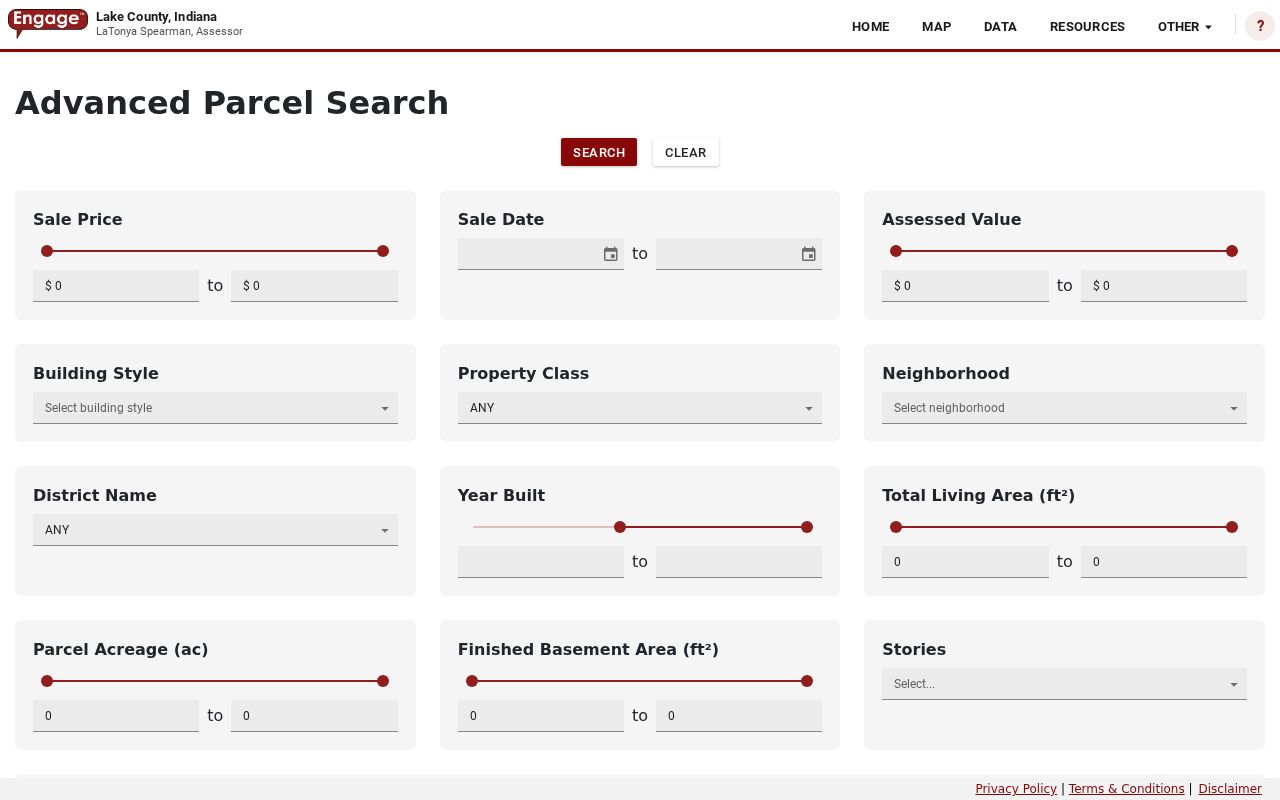
Use its neighborhood and district labels exactly as shown. Similar labels for Saint John corporation and Saint John Township can lead to different geographic areas.
St. John Records by Address
No single record names everyone on a St. John street. Each source contributes one layer, and each has its own access route. Online tools are strongest for parcels. Recorder copies may require an account or office contact, while town permit records may require a particular request for an existing file.
| Address Source | Custodian | Useful Evidence | Access Route |
|---|---|---|---|
| Property roll | Lake County Assessor | Deeded owner, situs and mailing address, parcel, values | Free XSoft search |
| Parcel map | Lake County Surveyor / GIS | Parcel shape, legal description, acres, linked county records | Free GIS Hub and feature service |
| Recorded instruments | Lake County Recorder | Deeds, plats, mortgages, liens, releases, easements | Login-gated web search; office fallback |
| Permits and notices | St. John Building and Planning / Clerk-Treasurer | Public project, hearing, inspection, and permit history | Cloudpermit, email or hard copy; APRA request |
| Voter geography | Lake County elections | Precinct, ward, town, school, and district map context | Public maps; controlled VRG-24 data request |
| Reverse directories | Libraries | Printed occupant clue arranged by address | Library shelf, microfilm, or staff request |
The assessor data table makes parcel rows easier to compare. The Lake County data view is shown here with the same columns a street researcher should record.
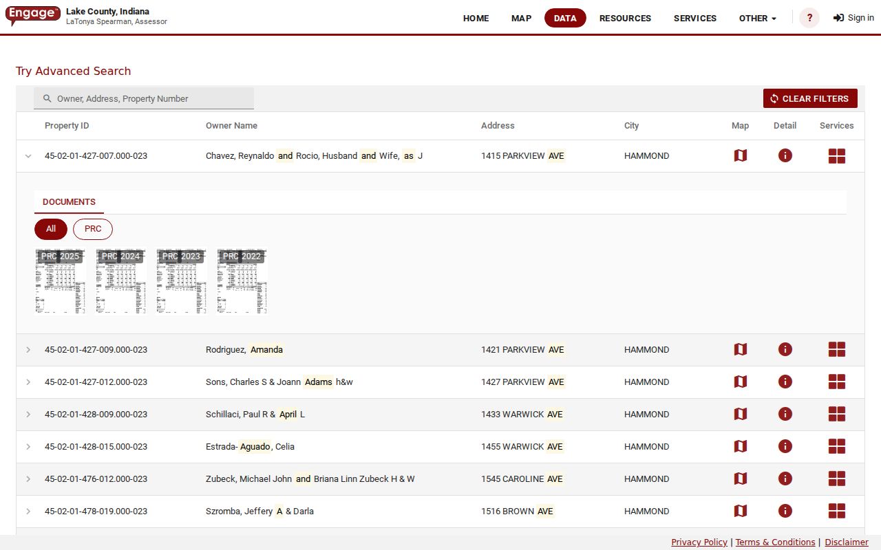
Property ID is the durable bridge. Names and mailing addresses may change, while the parcel reference keeps the property chain tied together.
Map St. John Parcel Rows
The county GIS layer turns a street name into a row of parcel polygons. Select one parcel, note its ID, then move to the lots on either side and across the road. The feature service exposes deeded owner, situs and mailing fields, legal description, acres, property class, section-township-range, municipal label, and links to county systems. The parcel layer was edited August 24, 2026, with its assessor and address-point tables updated during the same month.
The public Lake County GIS parcel layer documents those fields and the geometry used for street browsing.
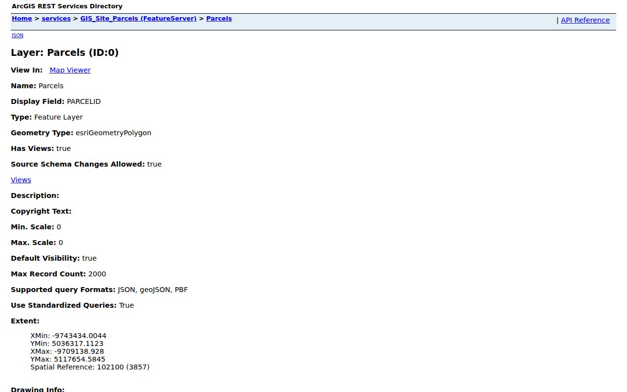
The map tells where parcels meet. It does not identify every person inside a building, and a parcel boundary is not a social boundary.
Three GIS tables serve different roles. The parcel layer carries geometry, deeded-owner and address fields. Its AssessorTable adds neighborhood code, property class, sale price, sale date, and reassessment fields without map shapes. The AddressPointTable adds the full address, postal community, postal code, unit type, unit ID, and PIN. Use the mapped parcel for the land boundary, then consult the related tables only for the facts needed. The service limits a response to 2,000 records, another reason to narrow the work to one street instead of trying to copy the county.
- Parcel
- A mapped unit of land with a county identifier.
- Situs address
- The physical address where the parcel sits, unlike the owner's tax mailing address.
- Plat
- A recorded map that lays out lots, roads, and easements in a subdivision.
- Criss-cross directory
- A directory arranged by street and house number instead of only by surname.
St. John Street Geography
ZIP 46373 is the Saint John postal identity, but it is not the incorporated town boundary. County assessor options also place Saint John corporation, Saint John Township, Center Township, Saint John Water, and nearby municipal combinations beside one another. A St. John street directory query can therefore catch a postal, township, taxing-district, or municipal use of the same place name.
Confirm the delivery string with USPS ZIP Code Lookup, then confirm the parcel's incorporated-municipality and district fields in GIS. Search St. John, Saint John, St John, and the assessor's compressed SAINTJOHN form when a result is missing. Carry Lake County and Indiana in notes so a similarly named place cannot enter the chain.
Geography check. A ZIP match narrows the postal area; only the parcel and municipal fields establish whether the land lies in incorporated St. John.
Trace St. John Street Owners
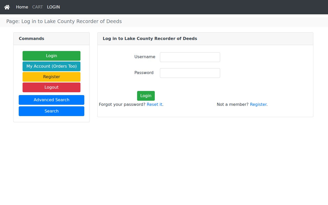
The Lake County Recorder holds the instruments that test an assessor name against title records. Its public Search and Advanced Search links route to login or registration. The office says its recordings span more than 200 years, but official sources did not state the exact online cutoff. Do not invent one. Search the current owner's name, follow grantor and grantee links, and compare every legal description before treating two documents as the same land.
The Recorder search login shows the access gate that appears before document searching.
If the web trail stops, call the Recorder at 219-755-3730 or visit during its listed weekday hours of 8:30 a.m. to 4:30 p.m. Online purchase information states $1 per page plus a $3 administrative fee per order. A certified or image copy carries more weight than an index line.
Recorded items do more than mark a sale. A plat can identify the lot and subdivision. An easement explains a right crossing the parcel. A mortgage or release dates a financial interest, while neither proves who occupied the home. One official county exhibit cites Book 24, Page 138, a section-township-range description, dimensions, signatures, an acknowledgment, and a map. That sample is not a St. John home deed, but it shows why the image matters: the legal description and attached exhibit can resolve a weak address match.
St. John Permits by Street
Town files can date visible changes that do not appear clearly in a deed. St. John Building and Planning routes permit submissions through Cloudpermit and also accepts material by email or hard copy. Plans, contractor names, inspections, and final survey material may exist when tied to a public permit, but no open address-keyed case index was verified.
Search St. John legal notices for the street, subdivision, variance, or hearing date. If a known record is not posted, use the Clerk-Treasurer's APRA form and describe the existing document, address, date range, and department. Indiana APRA does not require the town to create a new resident list. The direct request form allows email delivery or pickup and provides six lines for a particular description.
Keep the request narrow enough for staff to identify a file. Ask for a named permit, inspection, final surveyor location report, variance notice, or hearing record tied to the address and a date span. The town can convert an oral request to writing, and fees may apply. If the record belongs to police, county GIS, the assessor, or the recorder, route it to that custodian instead of asking the Clerk-Treasurer to collect records from another office.
Note: A permit names a project contact or owner at one date; it does not establish every occupant before or after the work.
Older St. John Address Clues
For past names at an address, move from current parcel work to library sources. The Crown Point resource list identifies Haines Criss Cross Northwest Indiana from 1982 to the present, plus phone books and scattered Robinson's directories. The Indiana State Library lists county-wide Polk issues for 2012, 2015, and 2020. Coverage must be checked issue by issue because no separate official St. John directory run was found.
A reverse listing is a lead, not final proof. Compare it with the parcel's legal description, a deed date, census schedule, obituary, or dated notice. The collections and their year runs belong on the St. John directory book page; the street directory uses them only after the current address is fixed.
St. John Voter Geography
The Lake County election map collection supplies precinct, ward, town, school, and district context for a street. Use those maps to label where an address falls, not to infer how anyone voted. The statewide Indiana Voters service is an individual registration and polling tool, not an open street roster.
A broader voter-data request uses county form VRG-24 and carries stated buyer and use limits. Protected fields and confidentiality-program addresses remain closed. For a normal street directory task, parcel and precinct geography are enough; do not claim names or address fields that the public lookup has not shown.
Limits of St. John Street Records
Property systems name a deeded owner, not every resident. A mailing address can point away from the parcel. A homestead deduction may support a residence inference, but it does not prove who is there today. Renters, children, guests, and other household members may never appear in an open address source. Indiana Voters provides an individual service, while bulk county voter data follows VRG-24 restrictions and protected fields remain closed.
Indiana also protects addresses for participants in its confidentiality program and permits covered-person restrictions in assessor records under IC 36-1-8.5. A blank or redacted result can reflect lawful protection, not a search error. DMV and utility account data are not substitutes for a public St. John street directory.
Lawful use. Use St. John address records for personal research, family history, property questions, and civic review. Never use them to stalk, harass, intimidate, or harm anyone.